Featured

Welcome to our blog

What we do…

This blog will explore some of the stories of Eastbourne, have a closer look at the objects in our collections and keep you up to date on what we’re up to!

To start us off, we present our mission statement:

Everyone leaves behind traces of their lives; a worn step, a scratched mark in a church wall, a lost button, a forgotten letter.

Using these physical traces we recreate past lives and tell lost stories of the people of Eastbourne.  

By making tangible links to real people, by walking the same ground, learning through life enhancing experiences, challenging the way people think and inspiring and stimulating debate, we explore what it means to be human in Eastbourne in a different time.

We intend to engage with every school child, every visitor, every resident, using the human experience, in the day to day lives of people in Eastbourne through time. We aim to empower the public with the opportunities to do this within their local environment and also at our exhibitions, through outreach, events and project work.

The Legend of Parson Darby ‘A Story Gallery’

Creative Brief

A new Story Gallery will be opening in December 2024 at the Beachy Head Story featuring the legend of Parson Darby and his fabled cave.  We would like to showcase and sell local artworks from the Gallery that represent the legend and show us new perspectives of the landscape.

Parson Darby’s Cave has long been described as a place of refuge for shipwrecked sailors, in the cliffs beneath Belle Tout. The legend goes that Jonathan Darby, Vicar of East Dean, dug out the chalk cave himself and stood there with a lantern on stormy nights to guide sailors to safety.  Other legends tell us this was a smuggler’s cave.

This is a landscape of constant change, the sea here surges against the cliffs at high tide, cutting off all paths to safety and eroding the fragile chalk.  Underneath the vanished chalk, harder rocks lay submerged beneath the waves, hidden reefs that have claimed shipwrecks by the hundreds.

Folklore develops itself in this landscape like an ongoing warning of the unseen perils at play.  In this landscape, even the Devil came to build a chimney, perhaps reminding sailors to be frightened of this place.  The Parson on the other hand, represents the lantern-light that shines through the darkness, offering hope to lost souls.

We’re exploring the history and mythology of the legend, building a picture of the lost landscape, the vanished caves, and the man who lived here three-hundred years ago – a man whose story we’re still telling.  We’re looking at the violence and danger of the coastline, the ships that wrecked here, and the ways that lives have been saved here.

Art Gallery

We’d like to see artwork that makes us see the landscape from different angles.  What traces of the dangers and hopes that have defined this place still exist here?  What is the Parson Darby legacy?

Call for Artists!

We’re looking for artists to represent this story in art form, this could be sculptures, ceramics, paintings, limited edition prints, jewellery, whatever you do.  Let us know what kind of art you make and how you would respond to the story.

We’ll be hosting the Story Gallery for six months so we may need multiple pieces from you to replace any pieces that we sell.  We retain 20% commission on all sales, so please price your pieces with this in mind!

Please send your pitches to Annalie.Seaman@lewes-eastbourne.gov.uk and Dave.Tomlins@lewes-eastbourne.gov.uk

Suggested Background Reading (Blogs):  https://heritageeastbourne.home.blog/blog-feed/ Parson Darby and the Legend of a Landscape, The Devil’s Chimney, The Three Charleses.

The Devils Chimney

~Posted by Dave~

This blog was originally posted as a four part series over a four month period. It has been combined into one blog here for ease of reading.

Part 1

There have been many natural features over the years that have come and gone from the Beachy Head landscape, great stacks of chalk, pinnacles jutting out to sea, cracks and gullies. Now long gone we had the likes of Cuillin crack, Etheldreda’s pinnacle, Pisgah and Sunday Sport. Some receiving their names from sailors, picking out landmarks from sea to aid navigation, some named by the Victorian climbing community, drawn to the extreme challenges involved in climbing* on the unstable chalk at Beachy Head. But in this blog, I’m going to explore a pinnacle that seems to have gained more notoriety and fame amongst locals then any other, The Devils Chimney.

Where was it? Who named it? Why the Devil?

Over the next few instalments of this blog, I’m going to try and answer these questions, starting with some context on the particularly interesting relationship that the Devil has had with Sussex!

The Devil vs Sussex

According to Bede, prominent 7th century monk and historian, Sussex was one of the last areas of the country to hold on to its pagan, pre-Christian belief systems. After the Romans left, the Saxon’s arrived in the 5th century bringing with them their pagan culture, reversing any remaining pockets of Christianity from the Roman era. It wasn’t until Æthelwealh took the Sussex throne in the 7th century (having been baptised in Mercia), that the county gained its first Christian king. Sussex legend tells that this late adoption of Christianity greatly angered the Devil! Perhaps he felt Sussex was his last great stronghold, he certainly went to great lengths to prevent the spread of Christianity into the area. This story of conflict between the angered devil and the good people of Sussex is reflected time and time again in our stories and folklore, much of it connected to the landscape around us.

The Devil in the landscape

The Devil, it seems, features quite prominently in our landscape, places and geographical features from around Sussex including;

  • The Devils Chimney, a now lost pinnacle of Beachy Head
  • The Devils Humps, four Bronze age barrows on Bow hill
  • The Devils Jumps, five Bronze age barrows on Treyford hill
  • Devils Bog, Ashdown forest
  • Devils Dyke, near Brighton
  • The Devils Book, earthwork at the foot of Mount Caburn

The most notorious of these being Devils Dyke;

“It is said the Devil was extremely unpleased with the new churches that were popping up around Sussex, upon its conversion to Christianity, so he decided to take action! One night, he took it upon himself to attempt to dig from the sea right up through downs, with the plan to flood Sussex and drown all its inhabitants. He dug as fast as he could, needing to complete his work before sunrise so as not to be discovered, there were clods of earth flying everywhere and according to local legend, upon landing these became Cissbury, Chactonbury and an extra large one landed to form Mount Caburn. All this activity was making a right racket! And it awoke a local woman, who got out of bed and went to her window to see what was going on. She soon realised what the devil was up to and quickly devised a plan. She took a candle, lit it and held it up to her window with a colander placed in front of it. The devil looked round, saw the light and thought it was sunrise, but how could it be sunrise already he thought? Then a cockerel, who had also seen the light and believed it to be sunrise, began to crow. That was enough for the devil, he was sure it must be sunrise and made his escape to evade being caught, the job only half finished, leaving us the dyke we see today.”

There are several variations on this folk tale, many involving local saints, some claiming that the devil dropped a huge clump of earth while escaping which formed the Isle of Wight! But this is the way I understand it and have always told it and it is a great example of how we use folklore and storytelling to interpret the landscape around us. This tale is not alone in its subject matter either, there are many stories connecting the Devil to topographical features in Sussex.

In part two we will take a closer look at the Devil’s Chimney itself and begin to discover how its featured in our landscape and folklore through the century’s.

*Please note that climbing on Beachy Head should absolutely not be attempted.

Part 2

Welcome to the second part of this blog and thanks for coming back! In part one we had a look at the relationship between the Devil, the people of Sussex and the landscape. Today, we will have a look at the Devils Chimney itself and begin to explore how it fits into local legend and folklore.

The Devils Chimney

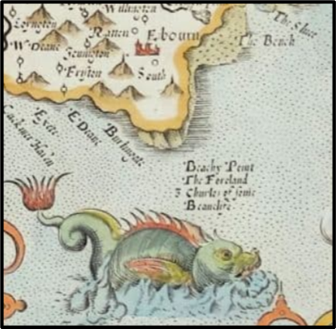
The Devils Chimney was a tall pinnacle that stood in front of Beachy head, formed as the soft chalk cliff fractures and recedes via erosion from sea and weather, leaving these huge towering monuments to where the coastline once was. Now, I use ‘a’ very loosely in that opening sentence, as it appears there has been more than one Devils Chimney! the most recent falling in 2001.

Historically, the Devil’s chimney has also referred to a steep passage way leading the cliff face from the top, as referenced in F. W. Bourdillon’s lecture to the Eastbourne Natural History Society. In fact he alludes that there is some sort of confusion between the Devils Chimney being a pinnacle when it was in fact a passage way. Also, just to add to the confusion, there was a rough ‘staircase’ that used to exist leading down to an area known as the gun garden at Beachy Head. This is often referred to as the ‘devils ladder’, but in a 1889 painting by Robert Morris titled ‘Devils Chimney and Gun Garden’, he certainly seems to be focused in on the rough staircase leading to the gun garden!

But, regardless, the opinion that the devils chimney was a pinnacle is far more widely accepted and this most certainly has been the case in more recent years, so for the sake of this blog, that is where our focus will lie.

  • Pre 1855

English Mountaineer and explorer Edward Wymper writes in his diary that he visited Eastbourne between the 21st of July and 9th of August 1855. He goes on to elaborate on this visit in his famous work ‘Scrambles Amongst the Alps’ 1871;

“As we steamed out into the Channel, Beachy Head came into view, and recalled a scramble of many years ago. With the impudence of ignorance, my brother and I, schoolboys both, had tried to scale the great chalk cliff. Not the head itself – where sea birds circle, and where the flints are arranged in orderly parallel lines – but at a place more to the east, where a pinnacle called the Devil’s Chimney had fallen down. Since then we have been often in dangers of different kinds, but never have we nearly broken our necks than upon that occasion”

This forms our first account of a Devils Chimney coming and going from the Beachy head landscape.

  • 27th of January 1956

“With the fall on Friday of the Devil’s Chimney, that familiar chalk pillar which has caught the imagination of untold numbers of visitor’s, the outline of Eastbourne’s famous headland, has somewhat changed” writes the Eastbourne Gazette. The fall is also reported up and down the country in various newspapers including Edinburgh Evening News, Hartlepool Northen Daily Mail and the Belfast Telegraph.

  • 3rd of April 2001

The most recent collapse of a Devil’s Chimney, as reported in The Argus and The Independent. The Argus reports “The Devil’s Chimney, just east of Beachy Head lighthouse, has been part of the 500ft-high cliff face for more than 50 years. It fell into the sea after heavy rain.”

So as far as we can see, there have been at least three instances a of Devil’s Chimney existing and subsequently falling. It’s interesting to note that in the 2001 fall, the Argus describes the pinnacle as being roughly over 50 years old (lining up nicely with the 1956 fall), supporting the preceding evidence that there have indeed been several Devil’s Chimneys.

It’s almost like ‘Devils Chimney’ keeps on getting recycled as the coastline changes and pinnacles come and go. Something about it just makes it keep reappearing, almost as one falls, we find ourselves another!

Local Historian, John Surtees, in his book ‘Beachy Head’ reports that after the 1956 Devils Chimney fall, Etheldreda’s pinnacle (briefly mentioned in part 1 of this blog) took on the name of Devils Chimney. This ties in nicely with information from ukclimbing.com, who report that in 2001, Etheldreda’s pinnacle was removed by a rock fall, the same date as the most recent collapse of a Devils Chimney. Further confirmation of this comes from Aleister Crowley (lots more on him later!), when he writes about his 1894 climbing attempts on Beachy Head and describes climbing both Etheldreda’s pinnacle and the Devils Chimney, so we know that two features with those names, co-existed at one point in time. This evidence makes it sound quite plausible that we are looking at an existing pinnacle adopting the name ‘Devils Chimney’, as another is lost. There are also many references to one of the ‘Charleses’ (three large rectangular pinnacles that stood at Beachy Head, now long lost around 1850) becoming a Devils Chimney, once reduced to a pointy stub by weather and erosion. In fact, it’s quite possible that Etheldra’s pinnacle was once a Charles and then subsequently a Devils Chimney!

So, why is the name being recycled? Could this have been a conscious decision to choose a new Devils Chimney once one had been lost? Perhaps the name ‘Devils Chimney’ is just so notorious that it’s the first thought that comes to people’s minds upon seeing a pinnacle at Beachy Head? Personally, I would go with the later of the arguments, as we can see, the 1956 collapse was being reported countrywide, demonstrating that the ‘Devils Chimney’ enjoys fame and importance not just in Eastbourne, but well outside of the local area too.

The prominence of folklore surrounding the Devil in Sussex (as discussed in part one), must be playing a part here too and as we saw previously, the Devils Chimney was not the only devil named feature at Beachy Head.  Although local folklore thinks of it being thrown up from below, rather than having been separated out from the sheer chalk cliff it stands beside. On the Devil’s Chimney, leading Sussex folklorist Jacqueline Simpson writes,

“…the story was that the Devil had built this chimney in order to smother the earth with smoke from hell, but just as he was finishing it a ship sailed by, and the cross formed by its mast and yard frustrated his evil plan…”

Much like the local legend of Devils Dyke (from part 1), we see a theme of the Devil plotting to unleash havoc and destruction, but is scuppered at the last moment! This is a common theme that runs throughout Sussex folklore concerning the Devil and the rest of the country for that matter too. The Devil pretty much always loses!

In part three of this blog, we will have a look into Aleister Crowley and his notorious relationship with the Devils Chimney and Eastbourne. Investigating the folklore and separating myth from fact.

Part 3

Welcome to the third part of this blog. In the last instalment of this blog, part two, we touched on some of the folklore surrounding the Devils Chimney, with the little-known legend that it was thrown up from hell by the Devil himself to smother Earth with smoke. But there is a far more famous legend locally about how the Devils Chimney got its name and it involves the notorious occultist, Aleister Crowley.

When the Devils Chimney is mentioned locally, there’s often a name mentioned not soon after, Aleister Crowley. Local legend tells us that he placed a curse on the town of Eastbourne…

When the Devil’s Chimney falls, Eastbourne will fall with it!

Well, the Devils Chimney has fallen multiple times, as we explored in the second part of this blog series and Eastbourne is still standing! But regardless, it’s a fascinating bit of more recent folklore and warrants some closer investigation!

Edward Alexander Crowley arrived in Eastbourne aged 19, in 1894. He had been sent to the town to continue his studies with a tutor named Lambert, having not been getting on well with boarding school. Lambert was a Plymouth Brother, a member of the nonconformist Christian Plymouth Brethren, of which Crowley’s father was an evangelist.  Crowley was a poet, a talented chess player, a reluctant academic and most importantly for the context of this blog, a keen mountaineer. During his stay in Eastbourne, between helping out Professor Hughs in the Chemistry department at Eastbourne College and playing chess at the local club, he also indulged in what was at the time his favourite activity, climbing.

The soft and loose chalk cliffs presented immense challenges to anyone who dared to attempt to climb at Beachy Head, with very few of the Victorian English climbing community, understandably, going anywhere near it. But Aleister Crowley liked to push boundaries and himself, so from April onwards in 1894, he made several attempts at climbing the various pinnacles, cracks and gullies around Beachy Head, many now long eroded away.

So, did Aleister Crowley name the Devils Chimney?

Well, it’s certainly commonplace for climbers to name new routes that they discover, especially if they can lay claim to being the first to conquer them. Aleister Crowley certainly did climb the Devils Chimney, his climbing exploits at Beachy Head are very well documented in an entry he wrote for the 1895 Scottish Mountaineering Journal.

“On July the 4th (1894) we made an attack on the Devil’s Chimney, a magnificent pillar of rock which projects boldly from the main cliff at a point rather to the W. of Etheldreda’s pinnacle. “Devil’s Chimney is a local name, and, as far as “chimney” goes, misleading to climbers. Nobody, however, who has been twice on the summit, as I have, will entertain the smallest doubt as to its ownership.”

So, as we can see from this quote, Aleister Crowley states that the Devil’s Chimney was already named as such by locals before his arrival in the area. This is of course backed up by part 2 of this blog, where we can see that the use of the name ‘Devils Chimney’ goes back at least 50 years prior to Aleister Crowley visiting Beachy Head. Although it looks like Aleister Crowley did name some features at Beachy Head while climbing. ‘Grants Chimney’, another pinnacle neighbouring Etheldreda’s pinnacle, was named after his cousin and climbing partner, Gregor Grant. Also, the much-mentioned Etheldreda’s pinnacle was in fact named after his dog!

This same evidence also disproves any theories that The Devils Chimney could have been named after Aleister Crowley, despite the undisputable presence that he had in the Beachy Head landscape, but let’s take a look at the most persistent of those theories, the curse…

Did Aleister Crowley curse Eastbourne?

Well, there are several variations on this story that I’ve heard over the years, but the most common seems to be that Aleister Crowley made an attempt at climbing The Devils Chimney, got stuck halfway up and then got laughed at by a few locals due to his predicament. This subsequently led to Crowley seeking revenge on Eastbourne locals for laughing at him and he placed a curse on the town, stating that when The Devils Chimney eventually fell into the sea, Eastbourne would fall with it!

So, we’ve already seen that Aleister Crowley did indeed climb on the Devils Chimney, several climbing attempts are documented, but amongst those accounts there are none of him getting stuck. It could be reasonable to think that such an embarrassing incident for a climber, could be omitted from any personal accounts, but in his entry in the Scottish Mountaineering Journal he speaks in great detail about an incident when he got stuck climbing ‘Cuillin crack’ at Beachy Head and had to be rescued by the coast guard! So this would lead me to believe, that there was no such incident involving The Devils Chimney.

Aleister Crowley was only 19 years old when he climbed at Beachy Head, although in his writings from around this time you can certainly start to see the beginnings of what would become a lifelong interest and involvement in the occult, I don’t think that he was practicing magick at this point in his life. So, I personally find it highly unlikely that he would have placed a curse or spell on Eastbourne, at that point in time anyway. It’s not to say that he couldn’t have remembered the incident and placed a curse some years later! But it’s not something that I’ve come across during my research into Aleister Crowley and it’s not something he mentions in his Autohagiography ‘The Confessions of Aleister Crowley’, in which he discusses his time in Eastbourne and Climbing at Beachy Head in some detail.

But, just in case, local white witch Kevin Carlyon held a cleansing ceremony at Beachy Head when the Devils Chimney fell, which was reported in national newspapers at the time, bringing rumours and legends of Aleister Crowley cursing Eastbourne, back to the forefront of the public mind.

Join me for part four, the final instalment of this of this blog. Where we will try and draw a conclusion about The Devils Chimneys and find out if we have answered the questions we set out to answer. Where was it? Who named it? Why the Devil?

Part 4

Welcome to the 4th and final entry of this blog series and thanks for sticking around! In this instalment, we are going to draw to a conclusion on The Devils Chimney (the best we can!) and ask, have we answered our original three questions about the Devils Chimney? Where was it? Who named it? Why the Devil? Well, I’m going to attempt to present a couple of theories based on the evidence from the last three instalments of this blog.

Where was it?

As we’ve come to realise over the last three instalments of this blog, it turns out that “where was it?” was not really the question we should have been asking! A more appropriate question, as we have now discovered, would have been “where were they?”.

In the second part of this blog, we looked at there being three distinct instances of Devils Chimneys collapsing, one pre 1855, one in 1956 and the most recent in 2001. All these occurred in a relatively small area of Beachy Head, just to the East of the Beachy Head Lighthouse. So why were they all basically next to each other?

As mentioned in the second part of this blog, long before any mentions of Devils Chimneys in the Beachy Head area, we have ‘the Charleses’, a prominent feature in the Beachy Head landscape. I won’t go into too much detail here, but the Charleses in a nut shell, were a number of towering pillars of chalk of quite a square shape, topped off with grass and level with the very top of the sheer chalk face. These are the result of sections of the cliff fracturing and beginning to move away from the front of the main headland. Over the years, as these get worn by the weather and action of the sea, they begin to crumble and fall apart, leaving a more jagged type of structure. I am of the opinion that the two pinnacles (the Devils Chimney and Etheldreda’s pinnacle) mentioned in this series of blogs are the result of the weathering process on The Charleses.

Please see the blogs on this website about The Charleses, for a far more in depth description and history of the Charleses.

The Charleses seem to feature in various maps and references from about the early 17th century onwards, but of more relevance to us, is when the last one fell and most sources seem to place that at some time around the early 1850’s. One of those sources is “Beachy Head, a paper read before the Eastbourne Natural History Society” by F. W. Bourdillon, published 1885. A valuable resource for anyone looking to build up an image in their mind of The Beachy Head landscape of the 19th century. Bourdillon suggests that the collapse of the last Charles is the collapse of the Devils Chimney, that Mountaineer and explorer Edward Wymper talks about in his 1871 work ‘Scrambles Amongst the Alps’, our first reference to a Devils Chimney collapsing. I have to say that I agree with him. I think that the name ‘The Devils Chimney’ first came into being as a nickname for one of The Charleses, most likely the last of them to fall, which leads us nicely onto our next question….

Who named it? Why the Devil?

I’m going to answer these two questions together, for the sake of keeping on topic and this blog not getting too long!

In part two of this blog I talked about the idea of the ‘Devils Chimney’ being recycled, the legend of the Devils Chimney persisting from generation to generation. As one pinnacle fell, a neighbour inherited the legend and had there moment with all the fame a notoriety that comes with such a prestigious title. But what I didn’t really touch on, is how it all started, how the name ‘Devils Chimney’ came to be in the first place…. Here is my theory….

When looking at the Beachy Head landscape the vast majority of us would have viewed these great pinnacles from above, stretching out to the sea below us as we stroll across the headland. But I want us to try and think about how these huge columns of chalk would have looked to the sea-faring community, be that fisherman or sailors, when viewed from sea level towering up in front of Beachy Head. Now the sea around Beachy Head was a treacherous place for sailors and fisherman, particularly in stormy conditions, even more so before any kind of lighthouse or attempts to shelter stranded sailors were introduced.  In a very severe storm, on a cold dark night, driving rain, gale force winds, jagged rocks below you ready to rip your vessel wide open at any moment! I think it would quite reasonable to assume that under those conditions, Beachy Head could certainly be perceived as the work of the Devil, or some sort of hell on earth.

The celebrated Eastbourne historian The Rev. Walter Budgen when writing of Beachy Head in his 1925 ‘Illustrated Guide to the Church Congress and Church Congress Exhibition’, spoke about old Venetian sailor men referring to the area as “Caput Doble” (i.e Diaboli, The Devil) on account of the unfriendliness and danger of the outlying rocks. Which adds further weight to the argument that the ‘Devils Chimney’ came into being by those who viewed it from below, not from above. I would also like to cast our minds back to end of the second part of this blog, where we had a look at the local folklore surrounding the Devils Chimney….

“…the story was that the Devil had built this chimney in order to smother the earth with smoke from hell, but just as he was finishing it a ship sailed by, and the cross formed by its mast and yard frustrated his evil plan…”

Now anyone who has ever taken the time to look up at Beachy Head from Eastbourne seafront, may have noticed that on occasion the summit can be engulfed in low cloud or a thick mist, just hanging motionless, like the smog above the tall chimneys of some great 19th century industrial area on a still day. Let’s think about how that would look to a sea-farer… (particularly a superstitious sea-farer and sailors are renowned for their superstitions and folklore, even having their own ‘sea-devil’ who dwelled below, commonly known by the name of Davy Jones)…..a great column of chalk over 500ft high, the very top protruding into this thick grey layer of fog like some humongous chimney belching out smoke, rising upwards from an area they liken to hell…… I think we can certainly begin to perceive how they would have thought of this great chimney to be the work of the Devil… The Devils Chimney.

Thank you very much for sticking with me and reading through this blog. Have we answered the questions we set out to? Well we have had a good go at it at the very least! We’ve presented a theory on the Devils Chimney, tried to find that point at which historical fact and folklore cross over and probably actually thrown up even more questions then we started out with! But, we will leave those for another day. Thanks, Dave.

Parson Darby and the Legend of a Landscape

Posted by Annalie Seaman

Part One: Parson Darby and the Legend of a Landscape. 

(First published 16th April 2023)

Land of Extremes

The Beachy Head Downland landscape is one of extremes, of terror and danger at the knife edge of the ocean, on a sunny day this is a pleasant place for a gentle stroll over undulating hills, on a windy day, this is a land of lashings, where foam-flecked waves thrash at the softest of rocks.

In the age of sail, this was a seascape of untold peril, where the sharp-toothed maw of ancient, stony fangs angled up to greet the hulls of wooden ships.  Hundreds of wrecks strew the seabed here, each one bearing the ghost of a story, all bound together by the legend of a long-gone soul who saved because he could.

The Echo of a Man

Tales woven into the fabric of this land paint a reverent portrait of a local vicar, one who served the local parishes of Wilmington, Litlington, Friston and East Dean between 1698 and 1726. 

The “Parson” was one Jonathan Darby, born in 1667 in Lemington, Gloucestershire.   He married Ann Segar in 1691 and they moved to Wilmington, home of the famous Long Man, in 1698.  By 1713, they had moved with their three sons to East Dean, a secluded Downland village nestled between Birling Manor and Friston.

He died in 1726, leaving an enigmatic gravestone and a folkloric mythos.  For one so long gone, whose centuries of absence outweigh the tenure of his life here, we have to ask, what keeps the vicar’s memory alive, what is the echo of the man?

The Legend of a Landscape

The name of Parson Darby is still passed from lip to lip in the telling of the land.  He is the hero this landscape demands.  He has outlived the memories of the lords and ladies of the green estates, beyond class, beyond wealth, beyond learning, the parson holds
this landscape in the grip of legend. 
He is said to have dug into the chalk of the sea cliffs with the strength of his own back, the callouses of his own hands, all alone, to shape caves of sanctuary into the cliffs of terror. 

Parson Darby’s Cave, or Parson Darby’s Hole as it is sometimes known, was a place of refuge for shipwrecked souls, a place where the parson could wait out storms with a lantern flashing out to sea, signalling ‘beware’ to passing ships on one of the busiest shipping lanes in the world.  It is said that he saved many lives in this way.

The Mythology of a Landscape

The cave was carved high into the chalk bedrock and accessed by chalk cut steps which led into an upper chamber, where someone could wait-out the tide.  They have been much discussed and occasionally photographed, they have been described and sketched and kept alive in the folk memory of this landscape.  They featured in Victorian
charabanc tours as a must-see destination after the visual delights of Beachy
Head’s charming landscape.

The cave does not exist.  Not anymore.  The sea has lapped away all trace of the cliffs that housed any such cave.  The story passed around hereabouts is that half a metre of
chalk cliff is lost to the elements every year, but that is not a consistent loss, the tide takes where it can, loosens from below and sucks at the sediments of the old cretaceous seabed indiscriminately.

There is no Parson Darby’s Cave, no hole.  Just ghost cliffs, where chalk once stood out to sea and is no more.  We pass around stories, not only of a long dead vicar, but also of long-lost land.  This is a landscape of pure mythology, it tells of a time that no longer exists and a land that refuses to accept its diminishment.

This Landscape Needs its Legends

There are stories of other caves carved here a century after the Parson’s cave was hollowed into the chalk, in the cliffs that are now ghosts of cliffs.  The new caves were fashioned in 1822 after the wreck of an East India Company ship, the Thames, which caused the town to be gifted its first lifeboat and sparked the construction of a series of
lighthouses to warn more mariners off the rocky shoals and reefs of the hidden
coast.

And still the shipwrecks piled up, and still the legend of the lone vicar and his cave is the story we want to tell.

This landscape is still rugged, it is bare-toothed and raw where its layers of tide-toughened geology strike out of the seabed, where its soft sediments crumble in straight-edged boulders to the beaches below.  Other heroes haunt these shores now, coastguards and lifeboat crews, but we think of them as a collective of heroes.

Just one man stands out above all the others as the pioneering hero of the Downland rim, the ‘sailors’ friend’.  The Legend that is Jonathan Darby.

What’s Next?

This is a journey of authentication, of sifting legends through the palms of our hands to see what is left at the core of the stories.  We’ll be seeking out the demonstrable histories, the provable facts, the hard evidence of years, and we’ll be comparing them with the legends, the myths, to see what remains once the mythos of a landscape has
been examined.

This is a story that lives in the nuances of the human psyche, and also in the collective psyche of landscape lore.  Follow the story as it unfolds through the years, back to these eighteenth century Downland communities and the lessons they learned about the land they called home.

Along the way, we’ll be finding out more about this landscape that we also call home.

Part Two: Caves to Rival Parson Darby’s?

(First published 8th May 2023)

Looking into the validity of Parson Darby’s Hole and all the legends that surround it gives us an interesting view of the landscape.  We’re uncovering not just one ghost-of-a-cave, but many ghostly caves.  One of the newspaper articles that has us intrigued was printed all around the country in March 1822. 

“At a general meeting of the Subscribers to Lloyd’s, held on Wednesday, a sum was voted for the purpose of cutting caves and steps in the cliffs in the vicinity of Beachy-Head, for affording protection to the crews and passengers of vessels which may be unfortunately wrecked on that dangerous coast, until they can be relieved from their distressed situation…

Sun (London), 22nd March 1822

This gives us a date, around a hundred years after Parson Darby’s death, for the cutting of new caves in the cliffs around Beachy Head, which raises a lot of questions. 

Who were Lloyd’s and why did they agree to pay for cliff caves?

Lloyd’s of London are a prosperous shipping insurance firm who were first established in a London Coffee House in 1652.  By 1734, they were publishing reliable daily shipping news listing departures, arrivals and ship’s cargoes, the location of other fleets and even the haunts of known pirates.   As the eighteenth century developed, they began recording shipping losses, keeping a watch on the shipping lanes from prominent landscapes like Beachy Head.  Hundreds of records are kept at Lloyd’s archives in London of all the wrecks they witnessed from the headland. 

As well as having a purpose built watchtower and Signalman’s Cottage on Beachy Head, Lloyd’s were investing in the cliffs themselves, which confirms that they were singularly worried about the dangerous shores and the effects of the seascape on the mariners who navigated these waters.

So shipping problems in the channel around Beachy Head caused new caves of refuge to be funded in 1822.  Does this mean then, that there was no other sanctuary in the cliffs themselves in 1822?  Was there no Parson Darby’s cave?  For a while the total debunk seemed possible, but a little more research has given us some further clues.

Were the ‘funded’ caves ever built, if so, how many were there and where were they?

The cliff caves of 1822 seem to have been more than just legend.  We have an article from the British Neptune in June of the same year which confirms that:

“…six caverns, with entrances three feet wide, and flights of steps 20 feet in height, terminating in an apartment eight feet square, have been cut in the cliffs between Cuckmere and Beachy Head…”

British Neptune, 23rd June 1822

Just three months after the funds were approved, the new Lloyd’s-funded caves had been cut!  Now we can imagine the white chalk face from the Beachy Head lighthouse to the Cuckmere river valley containing six freshly cut caves in 1822. 

Is that it then?  Were these the only cliff caves in the cliff face?  Was ‘Parson Darby’s cave only ever a figment of folklore?  Well no, not exactly.  The British Neptune article goes on to say:

“…and a place called Derby’s Cave repaired…”

So the legend that was ‘Derby’s Cave’ had been in a state of disrepair a century after the Parson’s lifetime.  We now need to picture seven caves along the six miles of chalk cliffs, cut into the soft rock around Birling Gap and the Seven Sisters.  Seven caves of refuge.  Seven chances for life in the storms and gales of this treacherous coast.

Do two newspaper articles provide absolute proof of Parson Darby and his chalky cave?  No, but the scent is thick here, we are sniffing out legend from fact and coming up with a whole new impression of Beachy Head and its forgotten landscape.  In trying to uncover facts about the Parson and his cave, we are virtually reconstructing centuries of the lost features of the Eastbourne Downs.

What’s next?  Well, there is still the question of the Parson, and whether he actually dug out a cave, and how many shipwrecks occurred here in his lifetime, and what the caves were used for and…

How many caves used to be carved into this landscape?

(Photo by DAVID ILIFF. License: CC BY-SA 3.0)

Part Three: What did the Parson call this landscape?

(First published 17th January 2024)

We’re shifting slightly sideways in this blog, looking at the names of this landscape as they have evolved over the centuries.  What the Parson new of this land is different to what we know of it.  There’s less of it for a start!  His cave and all the caves of refuge have fallen into the sea, the shape of the land is different, but oddly the names of the land are different too.  To trace this anomaly, we hit the old maps and old guidebooks and found a record of place names as shifting as the land itself.  Some names stick, but others come and go, here’s what we discovered about Beachy Head. . .

Beachy Head has been given many names over the last few hundred years, but one of the most unusual, is surely ‘The Three Charleses of Beachy Head’.

An early reference to the origins of the Charleses can be found in John Norden’s 1595 map of Sussex, where the headland is described as:

Detail from John Norden’s map of 1595 (Photo credit: Donald Selmes)

This version of John Norden’s map was printed in 1607 in the last edition of Cambden’s Britannia, compiled by Elizabeth I’s biographer, William Cambden, in an attempt to document Britain’s ancient pre-Roman past.  Cambden described the headland in reference to Norden’s map:

“And then at East-bourn the shore ariseth into so high a Promontory, called of the beach Beachy-points and Beau-cliffe (for the faire shew being interchangeably compounded with rowes of chalke and flint) that is esteemed the highest cliffe of all the South coast of England.”

Beachy Point indicates the highest chalk cliff on this part of the coast – an essential, bright white, navigational aid for the safe passage of ships through the channel. 

The Foreland is the promontory of the headland, geologically speaking, it also denotes the folded nature of the chalk geology. 

The 3 Churlos are three stacks of chalk that split away from the cliff and stood proud of the shoreline, adding further navigational landmarks to the headland. 

Beauclife is a ‘Beautiful cliff’, from the French Beau, meaning handsome, after the Latin Bellus (beautiful, pretty, handsome), and the Germanic clif and Dutch klif, meaning cliff, crag, or steep rock face.  The use of four place names for one headland was bound to lead to confusion in the following centuries.

Sussex, Norden & Kip map, 1637, still listing the Norden descriptions

What is a Churlos?

The root word, churl, comes from Middle English carl and German kerl, for ‘fellow or man’, and Anglo Saxon for Ceorl, meaning ‘free man’. 

For a stack of rock sticking out of the sea, ‘man’ has precedence amongst in the British Isles.  The Old Man of Hoy is a 449-foot sea stack on Hoy, in the Orkney archipelago.  The Old Man of Stoer is a 200-foot sea stack in Sutherland, Scotland.  A set of chalk stacks off the coast of Dorset are named for one particular man, Old Harry Rocks sit off Handfast Point, Isle of Purbeck. 

The tradition of nicknaming sea stacks and geological anomalies has come down to us through the centuries.  Were the Three Charles’ of Beachy Head once the Three Men of Beachy Head?

Many Names, One Headland

Norden’s 1595 map seemed to lay down a challenge of names, and subsequent cartographers chose which ones to adopt.  Two 1662 maps, the Blaeu Atlas Maior Anglia Regnum and Magnae Britanniae et Hiberniae Tabvia, labelled The Beache and The Beach.  Wenceslaus Hollar in 1668 labelled the headland Beau Cliffe, and in 1673, Richard Blome picked The Beach.

It was in 1724 that a significant shift in names provoked a cascade of changes to the local names.  Richard Budgen labelled the headland ‘Three Charles’s Beachy Head’ and shifted the name Belltout to the clifftop to the west of the promontory.  Tout comes from Middle English tute, meaning lookout.  From the beautiful cliff to a beautiful lookout, the beauty of the area simply shifted to another part of the map.

Also in 1724, Herman Moll produced a map of the area, directly calling the promontory Beachy Head.  A 1778 map by Yeakell and Gardner also labelled the headland Beachy Head.  By 1803 when Gustaf Klint penned his ‘map of the British Isles based on accurate intelligence’, the name Beachy Head had truly stuck to the landscape.

A Multiplication of Charleses

How many Charleses stood in the sea at Beachy Head?  Richard Budgen’s 1724 map listed ‘Seven Cliffs’, which we now recognise as the Seven Sisters, accurately ranging from Birling Gap to the Cuckmere Haven.

Detail from Richard Budgen’s map of 1724, naming the ‘Three Charles’s’

We’ve only seen three Charleses so far, but Herman Moll in the same year, as well as helping to popularise ‘Beachy Head’, also seemed to popularise a numerical blunder.  Off the coast of Moll’s Beachy Head, seven sea stacks appear to range from Beachy Head to the marshes of Langney.

Detail from Herman Moll’s map of 1724

Our enigmatic hero, Parson Darby was still a resident of East Dean when these maps were published. What do you think he made of the shifting place names and confusing numbers of way markers? 

See Parson Darby Blog – Part Four, The Changing Charleses, for the next part of the story.

Naming the Headland

~ Tales from the Beachy Head Story ~

~ Posted by Annalie ~

Parson Darby – Blog Three

Beachy Head has been given many names over the last few hundred years, but one of the most unusual, is surely ‘The Three Charleses of Beachy Head’.

An early reference to the origins of the Charleses can be found in John Norden’s 1595 map of Sussex, where the headland is described as:

Detail from John Norden’s map of 1595

This version of John Norden’s map was printed in 1607 in the last edition of Cambden’s Britannia, compiled by Elizabeth I’s biographer, William Cambden, in an attempt to document Britain’s ancient pre-Roman past.  Cambden described the headland in reference to Norden’s map:

“And then at East-bourn the shore ariseth into so high a Promontory, called of the beach Beachy-points and Beau-cliffe (for the faire shew being interchangeably compounded with rowes of chalke and flint) that is esteemed the highest cliffe of all the South coast of England.”

Beachy Point indicates the highest chalk cliff on this part of the coast – an essential, bright white, navigational aid for the safe passage of ships through the channel. 

The Foreland is the promontory of the headland, geologically speaking, it also denotes the folded nature of the chalk geology. 

The 3 Churlos are three stacks of chalk that split away from the cliff and stood proud of the shoreline, adding further navigational landmarks to the headland. 

Beauclife is a ‘Beautiful cliff’, from the French Beau, meaning handsome, after the Latin Bellus (beautiful, pretty, handsome), and the Germanic clif and Dutch klif, meaning cliff, crag, or steep rock face.  The use of four place names for one headland was bound to lead to confusion in the following centuries.

Sussex, Norden & Kip map, 1637, still listing the Norden descriptions

What is a Churlos?

The root word, churl, comes from Middle English carl and German kerl, for ‘fellow or man’, and Anglo Saxon for Ceorl, meaning ‘free man’. 

For a stack of rock sticking out of the sea, ‘man’ has precedence amongst in the British Isles.  The Old Man of Hoy is a 449-foot sea stack on Hoy, in the Orkney archipelago.  The Old Man of Stoer is a 200-foot sea stack in Sutherland, Scotland.  A set of chalk stacks off the coast of Dorset are named for one particular man, Old Harry Rocks sit off Handfast Point, Isle of Purbeck. 

The tradition of nicknaming sea stacks and geological anomalies has come down to us through the centuries.  Were the Three Charles’ of Beachy Head once the Three Men of Beachy Head?

Many Names, One Headland

Norden’s 1595 map seemed to lay down a challenge of names, and subsequent cartographers chose which ones to adopt.  Two 1662 maps, the Blaeu Atlas Maior Anglia Regnum and Magnae Britanniae et Hiberniae Tabvia, labelled The Beache and The Beach.  Wenceslaus Hollar in 1668 labelled the headland Beau Cliffe, and in 1673, Richard Blome picked The Beach.

It was in 1724 that a significant shift in names provoked a cascade of changes to the local names.  Richard Budgen labelled the headland ‘Three Charles’s Beachy Head’ and shifted the name Belltout to the clifftop to the west of the promontory.  Tout comes from Middle English tute, meaning lookout.  From the beautiful cliff to a beautiful lookout, the beauty of the area simply shifted to another part of the map.

Also in 1724, Herman Moll produced a map of the area, directly calling the promontory Beachy Head.  A 1778 map by Yeakell and Gardner also labelled the headland Beachy Head.  By 1803 when Gustaf Klint penned his ‘map of the British Isles based on accurate intelligence’, the name Beachy Head had truly stuck to the landscape.

A Multiplication of Charleses

How many Charleses stood in the sea at Beachy Head?  Richard Budgen’s 1724 map listed ‘Seven Cliffs’, which we now recognise as the Seven Sisters, accurately ranging from Birling Gap to the Cuckmere Haven.

Extract from Richard Budgen’s map of 1724, naming the ‘Three Charles’s’

We’ve only seen three Charleses so far, but Herman Moll in the same year, as well as helping to popularise ‘Beachy Head’, also seemed to popularise a numerical blunder.  Off the coast of Moll’s Beachy Head, seven sea stacks appear to range from Beachy Head to the marshes of Langney.

Extract from Herman Moll’s map of 1724

From here, the confusion only grows… 

(See Parson Darby Blog – Part Four, The Changing Charleses, for the next part of the story)

12th September 2023

Tales from The Beachy Head Story

~Posted by KS~

Wind was a bit gusty today wandering around Beachy Head Story.  The temperature has dropped but talking with my walking-friend, we decided there was no autumnal snap to the air, nor did it have any tinge of autumnal scents.  So no fungi to be found yet, also the grass is too long and verdant to expose the fungi fruiting heads, which is a shame as I was looking forward to a nice edible mushroom or two.  Instead there were many blackberries to forage, but bad news if trying to eat Purge Buckthorn which is named after its laxative effect.

There were definitely signs of a change in the season though when wandering along the less frequented, narrower, bramble  and gorse-strewn paths.  Hawthorn has berries that are turning from orange to red, similarly the dog rose hips are orange waiting to turn a vibrant red.  The elegant white Burnet roses seem to have finished with their rose hips, at least there was no sign of any on a short walk, and the Burnet roses are now just growing bright lime green new twigs and leaves ready for next year.

Splashes of yellow are still visible courtesy of straggly ragwort, home to the cinnabar moth caterpillar.  But more luminescent is the yellow toadflax.  This has little snapdragon flowers and stands upright amongst the grass and fights its way through the spread of wild clematis (seedheads known as Old Man’s Beard).  There’s a reminder of agrimony in a few stalks still flowering which is also a delicious yellow.  Along the path edges are low-growing clumps of the delicate small flowers of Eye bright a traditional herb supposedly used for centuries for sore eyes.

Eye bright

Hawthorn berries

Dog Rose hips

Purge Buckthorn

Yellow toadflax

Agrimony

8th August 2023

Tales from The Beachy Head Story

~Posted by KS~

Loads of wild carrot in the Beachy Head Story area today.  The plants seem to be having a second flowering now we’ve had quite a lot of rain.  Some of the umbellate flowers have a little brown / purple central floret that may have something to do with attracting insects and is a useful identifying feature of wild carrot (aka Queen Anne’s Lace).  Wild carrot / Queen Anne’s Lace has delicate florets, grows about 1m tall. 

There is also alot of Common Hogweed flowering at the moment.  It is native to the UK and is in flower most of the summer months.   It looks much more robust that the wild carrot and more suited to the winds that can lash this high part of coastal Downland.  I certainly found it windy out and about today and rescued my glasses a couple of times as hefty gusts of wind flew them off my head. 

I haven’t seen any Hemlock in my 10 minute-walk-radius of Beachy Head Story.  This is an umbellate to avoid, one that is confusingly similar to wild carrot, and one that is toxic.  I’ve not seen Giant Hogweed either in the same area.  This plant is bad news.  It is tall (3-5m), has spiky purpled splodged stems and shouts “avoid me” and its sap causes nasty blistering.

It feels like having settled down for an early autumn forming seedheads galore, the vegetation around the Beachy Head Story has decided it is after all summer, and time to be green again and send up new flowers.  The Knapweeds are beautifully purple again / still.  Ragwort is blisteringly yellow again.  Surprisingly few poppies here throughout the summer season, though there are some lovely low growing small scabious.  The grasses are again green, morphing from harvest colours back to growth.  Wandering around, and mulling over my observations, the descriptions remind me of actor Dirk Bogarde’s book A Gentle Occupation where he refers to his past times in the south Downs as well as southern France.  Perhaps I’ve appropriated his musings and writings.  

Hemlock (toxic)  (Conium maculatum)

Queen Anne’s Lace (aka Wild Carrot) (Daucus carota)

Common Hogweed (Heracleum sphondylium)

Cow Parsley   (Anthriscus sylvestris)

Giant hogweed (Heraculum mantegazzionum) is bad news.  Its sap on skin usually causes blistering.  It grows tall (3-5m) and has purple blotches on spiky stems.

https://www.environetuk.com/invasive-species/giant-hogweed/identification

Want to avoid being poisoned? Want to avoid skin blistering?

Umbellate identification helps:     

https://www.countryfile.com/wildlife/trees-plants/umbellifers/

Wildflowers of Beachy Head

Posted by KS

Tuesday 20th June 2023

Finished my meander by walking around in the clouds today outside Beachy Head Story.  It had been warm and sunny, which perhaps encouraged this Thick Legged Flower Beetle out and about, not seen one before but web-info says common in Europe and southern England.  Found quite a number of Pyramid orchids just off the path.  Heard the raven but sadly didn’t see it today.

Thick Legged Flower Beetle on Hawkweed
Pyramidal Orchid

Tuesday 18th July 2023 

There’s a definite change from the chalkland spring flowers into the summer flowers around the Beachy Head Story.  The grasses are now golden with seedheads wafting in the wind.  There were loads of little insects flitting around the grasses and plants today moving too fast to identify, but also sedentary ones like this Cinnabar moth caterpillar and Red Soldier Beetle on some ragwort.

The Wild Carrot smells a bit of carrot and has another name of Queen Anne’s Lace.  It has a tiny purple or dark red in the centre of the dainty white florets and may have a function in attracting insects to the flower heads.  It is a useful identification feature, as the very similar looking Hemlock is toxic.

The scabious are coming out, and there are patches of aromatic wild thyme if you meander off the tarmac paths.

Cow Parsley or Queen Anne’s Lace
Cinnabar moth caterpillar and Red Soldier Beetle on some ragwort

Tuesday 25th July 2023

It’s windy outside Beachy Head Story today.  The grasses are bent away from the prevailing wind.  The bit of rain has rejuvenated the predominant gold and the Downs have verdant tones.  Walking along the grass paths, I wondered if or how this affected flowering or if it marked a change into another phase of Downland vegetation blooming. 

The orchids have finished.  The greater knapweed has mostly finished leaving silvery gold seed head casings to glint in the sunlight, but the lesser knapweed has started flowering which while no-where near as flamboyant having no long florets, the purple colour is just as strident.

There are a few patches of little quaking grass.  This delicate grass is low growing in this area, I assume for wind management.  I found myself watching it dance in the wind for longer than I’m willing to say, it was mesmerising.  The white clover has made a come-back with the rain and covers a number of paths.  It must be tough to withstand so many people walking on it.  To finish off my short walk, I saw a marbled white butterfly near the clover battling the gusty wind.

Greater Knapweed
Lesser Knapweed
Little Quaking Grass

Holes to rival Parson Darby’s?

~Tales from The Beachy Head Story~

Posted by: Annalie

Parson Darby – Blog One

Looking into the validity of Parson Darby’s Hole and all the legends that surround it gives us an interesting view of the landscape.  We’re uncovering not just one ghost-of-a-cave, but many ghostly caves.  One of the newspaper articles that has us intrigued was printed all around the country in March 1822. 

“At a general meeting of the Subscribers to Lloyd’s, held on Wednesday, a sum was voted for the purpose of cutting caves and steps in the cliffs in the vicinity of Beachy-Head, for affording protection to the crews and passengers of vessels which may be unfortunately wrecked on that dangerous coast, until they can be relieved from their distressed situation…

Sun (London), 22nd March 1822

This gives us a date, around a hundred years after Parson Darby’s death, for the cutting of new caves in the cliffs around Beachy Head, which raises a lot of questions. 

Who were Lloyd’s and why did they agree to pay for cliff caves?

Lloyd’s of London are a prosperous shipping insurance firm who were first established in a London Coffee House in 1652.  By 1734, they were publishing reliable daily shipping news listing departures, arrivals and ship’s cargoes, the location of other fleets and even the haunts of known pirates.   As the eighteenth century developed, they began recording shipping losses, keeping a watch on the shipping lanes from prominent landscapes like Beachy Head.  Hundreds of records are kept at Lloyd’s archives in London of all the wrecks they witnessed from the headland. 

As well as having a purpose built watchtower and Signalman’s Cottage on Beachy Head, Lloyd’s were investing in the cliffs themselves, which confirms that they were singularly worried about the dangerous shores and the effects of the seascape on the mariners who navigated these waters.

So shipping problems in the channel around Beachy Head caused new caves of refuge to be funded in 1822.  Does this mean then, that there was no other sanctuary in the cliffs themselves in 1822?  Was there no Parson Darby’s cave?  For a while the total debunk seemed possible, but a little more research has given us some further clues.

Were the ‘funded’ caves ever built, if so, how many were there and where were they?

The cliff caves of 1822 seem to have been more than just legend.  We have an article from the British Neptune in June of the same year which confirms that:

“…six caverns, with entrances three feet wide, and flights of steps 20 feet in height, terminating in an apartment eight feet square, have been cut in the cliffs between Cuckmere and Beachy Head…”

British Neptune, 23rd June 1822

Just three months after the funds were approved, the new Lloyd’s-funded caves had been cut!  Now we can imagine the white chalk face from the Beachy Head lighthouse to the Cuckmere river valley containing six freshly cut caves in 1822. 

Is that it then?  Were these the only cliff caves in the cliff face?  Was ‘Parson Darby’s cave only ever a figment of folklore?  Well no, not exactly.  The British Neptune article goes on to say:

“…and a place called Derby’s Cave repaired…”

So the legend that was ‘Derby’s Cave’ had been in a state of disrepair a century after the Parson’s lifetime.  We now need to picture seven caves along the six miles of chalk cliffs, cut into the soft rock around Birling Gap and the Seven Sisters.  Seven caves of refuge.  Seven chances for life in the storms and gales of this treacherous coast.

Do two newspaper articles provide absolute proof of Parson Darby and his chalky cave?  No, but the scent is thick here, we are sniffing out legend from fact and coming up with a whole new impression of Beachy Head and its forgotten landscape.  In trying to uncover facts about the Parson and his cave, we are virtually reconstructing centuries of the lost features of the Eastbourne Downs.

Wiser people might have put down their pens and investigating hats by now, having unearthed a new (old) landscape, but not us.  There is still the question of the Parson, and whether he actually dug out a cave, and how many shipwrecks occured here in his lifetime, and what the caves were used for and…

How many caves were once housed in this stretch of chalk cliff?

(Photo by DAVID ILIFF. License: CC BY-SA 3.0)

Parson Darby and the Legend of a Landscape

~Tales from the Beachy Head Story~
Posted by: Annalie

Parson Darby – Blog One

A Land of Extremes

The Beachy Head Downland landscape is one of extremes, of terror and danger at the knife edge of the ocean, on a sunny day this is a pleasant place for a gentle stroll over undulating hills, on a windy day, this is a land of lashings, where foam-flecked waves thrash at the softest of rocks.

In the age of sail, this was a seascape of untold peril, where the sharp-toothed maw of ancient, stony fangs angled up to greet the hulls of wooden ships.  Hundreds of wrecks strew the seabed here, each one bearing the ghost of a story, all bound together by the legend of a long-gone soul who saved because he could.

The Echo of a Man

Tales woven into the fabric of this land paint a reverent portrait of a local vicar, one who served the local parishes of Wilmington, Litlington, Friston and East Dean between 1698 and 1726. 

The “Parson” was one Jonathan Darby, born in 1667 in Lemington, Gloucestershire.   He married Ann Segar in 1691 and they moved to Wilmington, home of the famous Long Man, in 1698.  By 1713, they had moved with their three sons to East Dean, a secluded Downland village nestled between Birling Manor and Friston.

He died in 1726, leaving an enigmatic gravestone and a folkloric mythos.  For one so long gone, whose centuries of absence outweigh the tenure of his life here, we have to ask, what keeps the vicar’s memory alive, what is the echo of the man?

The Legend of a Landscape

The name of Parson Darby is still passed from lip to lip in the telling of the land.  He is the hero this landscape demands.  He has outlived the memories of the lords and ladies of the green estates, beyond class, beyond wealth, beyond learning, the parson holds this landscape in the grip of legend

He is said to have dug into the chalk of the sea cliffs with the strength of his own back, the callouses of his own hands, all alone, to shape caves of sanctuary into the cliffs of terror. 

Parson Darby’s Cave, or Parson Darby’s Hole as it is sometimes known, was a place of refuge for shipwrecked souls, a place where the parson could wait out storms with a lantern flashing out to sea, signalling ‘beware’ to passing ships on one of the busiest shipping lanes in the world.  It is said that he saved many lives in this way.

The Mythology of a Landscape

The cave was carved high into the chalk bedrock and accessed by chalk cut steps which led into an upper chamber, where someone could wait-out the tide.  They have been much discussed and occasionally photographed, they have been described and sketched and kept alive in the folk memory of this landscape.  They featured in Victorian charabanc tours as a must-see destination after the visual delights of Beachy Head’s charming landscape.

The cave does not exist.  Not anymore.  The sea has lapped away all trace of the cliffs that housed any such cave.  The story passed around hereabouts is that half a metre of chalk cliff is lost to the elements every year, but that is not a consistent loss, the tide takes where it can, loosens from below and sucks at the sediments of the old cretaceous seabed indiscriminately.

There is no Parson Darby’s Cave, no hole.  Just ghost cliffs, where chalk once stood out to sea and is no more.  We pass around stories, not only of a long dead vicar, but also of long-lost land.  This is a landscape of pure mythology, it tells of a time that no longer exists and a land that refuses to accept its diminishment.

This Landscape Needs its Legends

There are stories of other caves carved here a century after the Parson’s cave was hollowed into the chalk, in the cliffs that are now ghosts of cliffs.  The new caves were fashioned in 1822 after the wreck of an East India Company ship, the Thames, which caused the town to be gifted its first lifeboat and sparked the construction of a series of lighthouses to warn more mariners off the rocky shoals and reefs of the hidden coast.

And still the shipwrecks piled up, and still the legend of the lone vicar and his cave is the story we want to tell.

This landscape is still rugged, it is bare-toothed and raw where its layers of tide-toughened geology strike out of the seabed, where its soft sediments crumble in straight-edged boulders to the beaches below.  Other heroes haunt these shores now, coastguards and lifeboat crews, but we think of them as a collective of heroes.

Just one man stands out above all the others as the pioneering hero of the Downland rim, the ‘sailors’ friend’.  The Legend that is Jonathan Darby.

What’s Next?

This is a journey of authentication, of sifting legends through the palms of our hands to see what is left at the core of the stories.  We’ll be seeking out the demonstrable histories, the provable facts, the hard evidence of years, and we’ll be comparing them with the legends, the myths, to see what remains once the mythos of a landscape has been examined.

This is a story that lives in the nuances of the human psyche, and also in the collective psyche of landscape lore.  Follow the story as it unfolds through the years, back to these eighteenth century Downland communities and the lessons they learned about the land they called home.

Along the way, we’ll be finding out more about this landscape that we also call home.

Revealing a refugee’s story

Kasey

This post was originally written in 2016

At Heritage Eastbourne we all have a passion for discovering and sharing stories about Eastbourne’s past. It’s really exciting to come across objects that illumine human experiences at different times in history. One in particular moved us greatly last week.

We spend some of our time going through boxes of unaccessioned Local and Social History items. Last Thursday, we came across a collection of photographs, the first of which showed two young boys sitting side by side with toys. We didn’t think much of it, of course it must have meant something to someone at some point in time. But in that moment it was impossible to know just how much. 

Hana Mullerova’s Nephews

It was the accompanying object that gave a long kept secret away. A seemingly innocuous booklet turned out to be an Alien Certificate of Registration, belonging to Czech Jewish refugee, Hana Mullerova, stamped in Eastbourne on 21st February 1939.

The significance of this date is that it shows Hana arrived in Eastbourne one month before the German Armymoved into the remainder of Czechoslovakia, a year after the Nazi annexation of what was called the Sudetenland, Czechoslovakia’s northern and western border regions. This occupation had an unfathomable impact on the 356,830 people there who identified as Jewish.

Hana was born in 1905 in the Czech town of Lindava. She had a married sister and two nephews. At the age of 33 Hana was sent to England in 1939 to escape the Nazis.  Only 26 000 Jewish individuals were able to emigrate before 1941 a year that saw the beginning of mass deportations to Theresienstadt (near Prague) and then further east.  Hana was one of the 26 000. Once she arrived in Eastbourne  she managed to get tickets for her family to travel to England but they were a day too late. Her entire family perished in concentration camps. Hana treasured the photographs she had of her family, especially her nephews, they were the only tangible reminders of them all.

Hana (back row right) with her parents (front centre)
A page from Hana’s Alien Registration Certificate

Hana found work as a maid, one of the few occupations open to alien girls and women. She had to report weekly to the police station to have her Aliens’ Registration book stamped.

Hana became a naturalised British Citizen in November 1947. Many Jewish refugees and other ‘Alien’ residents became naturalised British Citizens after the war. Hana then worked in the office at Mansfield’s (Motor sales and service) in Cavendish Place until her retirement.

Hana later in life. She passed away in July 1985

Time has a way of making certain events innocuous. Over 75 years separates us from the Holocaust, but through these objects our concept of time is transcended and we are able to recover stories that fear and history and trauma have conspired to suppress. Hana kept her pain to herself for most of her life. It was only when she began treatment for cancer, and befriended a volunteer ambulance driver, that her story both surfaced and transferred into the care of another human being.

Design a site like this with WordPress.com
Get started